7 Days Kilimanjaro Climb Machame Route
Customize Your Adventure, Create Lifelong Memories
Tour Overview
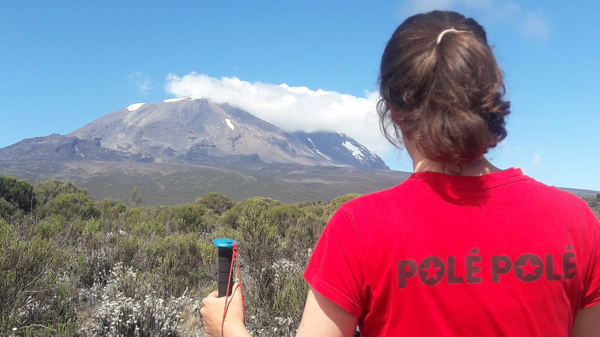
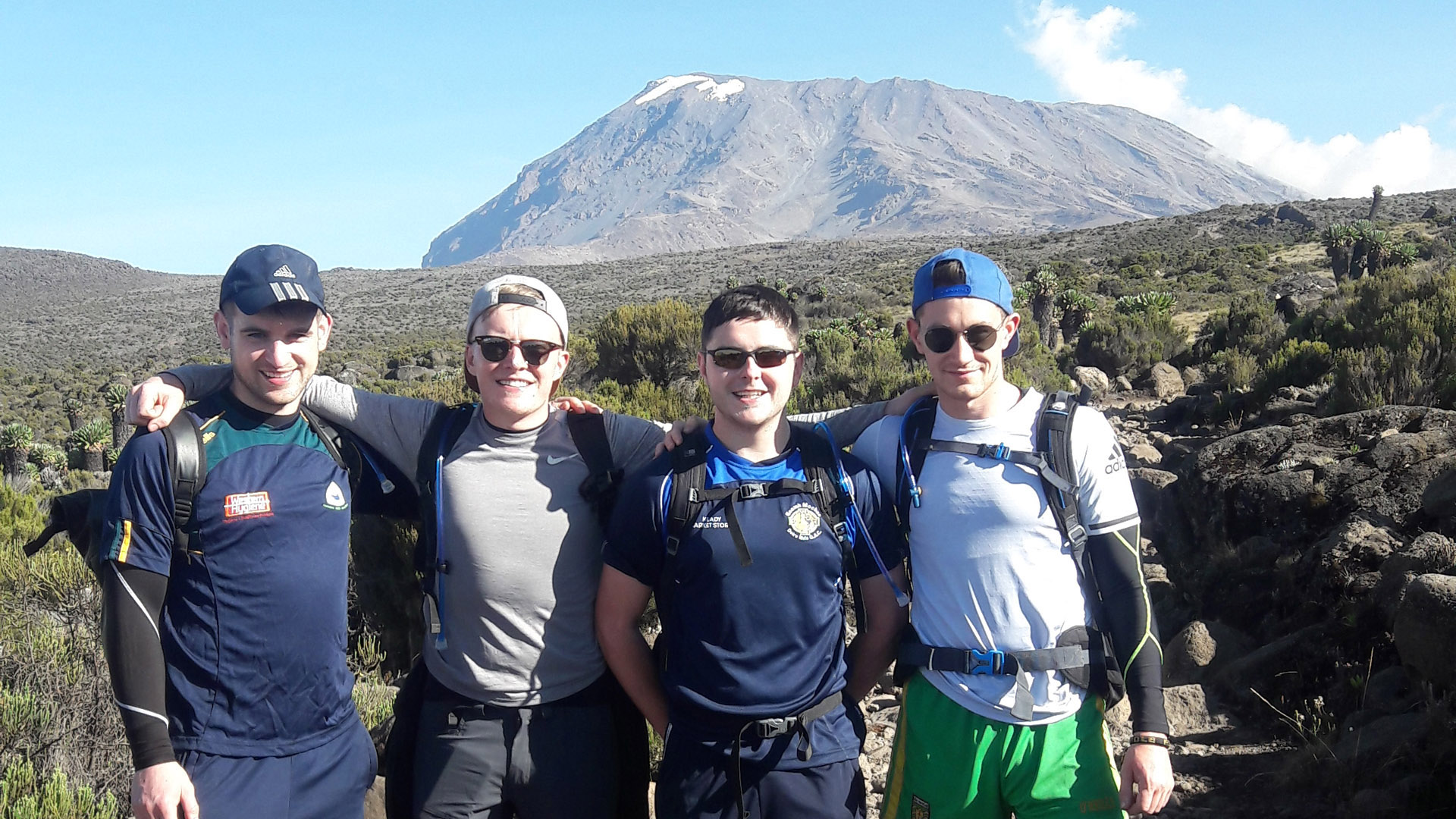
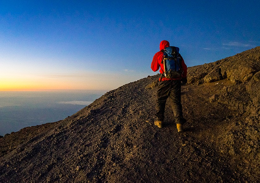
The 7 Days Mount Kilimanjaro Trekking Machame Route is a popular hiking adventure that takes you to the summit of the highest peak in Africa, Mount Kilimanjaro. The Machame Route is one of the most scenic and challenging trails, known for its diverse landscapes and stunning views. The trek typically begins in the lush rainforest and progresses to the alpine desert, passing through different ecological zones along the way. The trek lasts for 7 days, with each day involving an average of 6 to 7 hours of hiking. The climb to the summit is a grueling challenge, but the breathtaking views from the top make it all worth it. The Machame Route is suitable for experienced hikers who are physically fit and prepared for high altitude trekking.
Tour Itinerary
The drive from Moshi to the Machame Gate takes about 50 minutes. The journey passes through the village of Machame which is located on the lower slopes of the mountain. As we leave the park gate, we walk through the dense rain forest on a winding trail up a ridge until we reach the Machame Camp.
- Elevation: 5,380 ft to 9,350 ft
- Distance: 11 km/7 miles
- Hiking Time: 5-7 hours
- Habitat: Rain Forest
Accommodation: Machame Camp
We leave the glades of the rain forest and continue on an ascending path up to a steep, rocky ridge. On the Shira Plateau, we pass through heather and open moorlands, then cross a large river gorge to Shira 2 Camp.
- Elevation: 9,350 ft to 12,500 ft
- Distance: 5 km/3 miles
- Hiking Time: 4-7 hours
- Habitat: Heath
Accommodation: Shira 2 Camp
We continue to the east up a ridge and then head southeast towards the Lava Tower – a 300 ft tall volcanic rock formation. We descend down to Barranco Camp through the strange but beautiful Senecio Forest to an altitude of 13,000 ft. Although you begin and end the day at the same elevation, the time spent at higher altitude is very beneficial for acclimatization..
- Elevation: 12,500 ft to 15,190 ft
- Distance: 7 km/4 miles
- Hiking Time: 4-5 hours
- Habitat: Alpine Desert
- Lava Tower to Barranco Camp
- Elevation: 15,190 ft to 13,044 ft
- Distance: 3 km/2 miles
- Hiking Time: 2-3 hours
- Habitat: Alpine Desert
Accommodation: Lava Tower
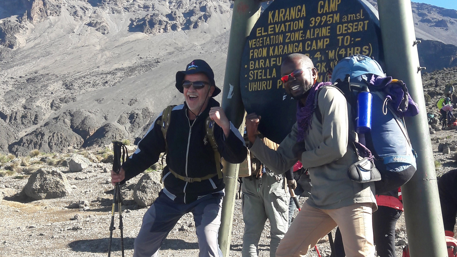
We begin the day by descending into a ravine to the base of the Great Barranco Wall. Then we climb the non-technical but steep, nearly 900 ft cliff. From the top of the Barranco Wall we cross a series of hills and valleys until we descend sharply into Karanga Valley. One more steep climb up leads us to Karanga Camp. This is a shorter day meant for acclimatization..
- Elevation: 13,044 ft to 13,107 ft
- Distance: 5 km/3 miles
- Hiking Time: 4-5 hours
- Habitat: Alpine Desert
Accommodation: Karanga Camp
We leave Karanga and hit the junction which connects with the Mweka Trail. We continue up to the rocky section to Barafu Hut. At this point, you have completed the Southern Circuit, which offers views of the summit from many different angles. Here we make camp, rest and enjoy an early dinner to prepare for the summit day. The two peaks of Mawenzi and Kibo are viewable from this position.
- Elevation: 13,107 ft to 15,331 ft
- Distance: 4 km/2 miles
- Hiking Time: 4-5 hours
- Habitat: Alpine Desert
Accommodation: Barafu Camp
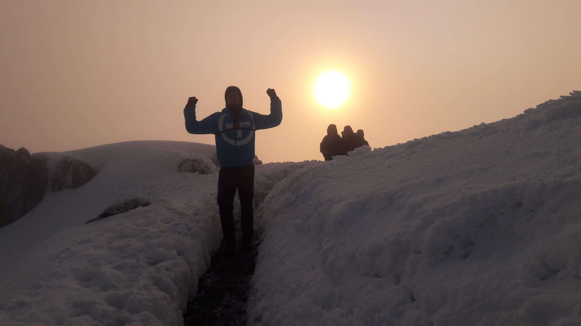
Very early in the morning (around midnight), we begin our push to the summit. This is the most mentally and physically challenging portion of the trek. The wind and cold at this elevation and time of day can be extreme. We ascend in the darkness for several hours while taking frequent, but short, breaks. Near Stella Point (18,900 ft), you will be rewarded with the most magnificent sunrise you are ever likely to see coming over Mawenzi Peak. Finally, we arrive at Uhuru Peak- the highest point on Mount Kilimanjaro and the continent of Africa.
From the summit, we now make our descent continuing straight down to the Mweka Hut camp site, stopping at Barafu for lunch. The trail is very rocky and can be quite hard on the knees; trekking poles are helpful. Mweka Camp is situated in the upper forest and mist or rain can be expected in the late afternoon. Later in the evening, we enjoy our last dinner on the mountain and a well-earned sleep.
- Elevation: 15,331 ft to 19,341 ft
- Distance: 5 km/3 miles
- Hiking Time: 7-8 hours
- Habitat: Arctic
- Uhuru Peak to Mweka Camp
- Elevation: 19,341 ft to 10,065 ft
- Distance: 12 km/7 miles
- Hiking Time: 4-7 hours
- Habitat: Rain Forest
Accommodation: Uhuru Peak
On our last day, we continue the descent to Mweka Gate and collect the summit certificates. At lower elevations, it can be wet and muddy. From the gate, we continue another hour to Mweka Village. A vehicle will meet us at Mweka Village to drive us back to the hotel in Moshi.
- Elevation: 10,065 ft to 5,380 ft
- Distance: 10 km/7 miles
- Hiking Time: 3-4 hours
- Habitat: Rain Forest
Accommodation: Mweka Gate
Includes
- Private transport to & from Kilimanjaro International Airport to your accommodations in Moshi
- 2 nights of accommodation in Moshi
- Transportation to & from the Kilimanjaro gate
- Park entry fees
- 18% VAT on tour fees & services
- 3 meals daily while on the mountain
- Enough treated & filtered drinking water throughout the trek
- Friendly and professional mountain guides, cook and porters
- Government taxes
- Fair wages for the mountain crew as approved by the Kilimanjaro National Park Authority (KINAPA), Kilimanjaro Association of Tour Operators (KIATO)
- Portable oxygen tanks
- Ox meter
- Emergency first-aid kit
- Stethoscope
- Portable flush toilet with a toilet and tent
- Mountain climbing certificates
Excludes
- Flights (International)
- Alcoholic and soft drinks
- Visa fees
- Travel insurance
- Meals while in Hotel
- Laundry (Available at the hotel)
- Personal items and toiletries
- Tips for guides, porters and cook
Price From
Book This Tour
Related Tours You may Like
- Quality4.67
- Location5
- Amenities4.33
- Services5
- Price4
5 Days Kilimanjaro Climbing Marangu Route
- Quality4.67
- Location5
- Amenities4.33
- Services5
- Price4
6 Days Kilimanjaro Climbing Rongai Route
Hear from our happy travelers
Verified Inoubliable Expérience inoubliable grâce à Regan et Saidi qui ont toujours été à l’écoute et de bon conseil pour nous !Merci pour tout Rosh Expéditions.Verified All the things you need from a guide. We (us 2) went for a 4-day hike on Mount Meru. We were picked up on time and everything was well organized.Regan is a good guide with lots of experience, and has a good sense of humor. Regan is the guide of a team which consists of friendly and helpful people who will make you feel comfortable throughout the trip. We experienced this once one of us got very ill due to a bite of a tick. Although we were unfortunate to cancel the trip, Regan and his team made Sure we got down well and safe and made our way back to Arusha. Not making it to the Summit was an enormous dissapointment, however, travelling and guidance by Regan and his team was a 5-star experience.Excellent guide, responsible behaviour, Nice food and kind/warm people.Verified Climbing the Kili, crazy experience I had a wonderful time with Regan, Said and the whole team of Roshi Expeditions on the climb to Kilimanjaro.They will make sure you will climb safe and provides an incredible service when it comes to comfort and quality of life in the camp.It was a unforgettable experience, we made friends and memories. Thank you again and best of luck for the future ! JulienVerified Excellent - do it with ROSHEXPEDITIONS Regan and Saïd were such great guides. They accompanied us all the way up Kilimanjaro. The atmosphere was so cool. The porters were also incredible. They were all extremely professional and friendly. There's nothing to say. What's more, the guides shared their knowledge of the natural environment surrounding Kilimanjaro National Park with us. They took good care of us when we were a bit ill. Without the porters and guides, we'd never have made it. And above all, thank you to Regan for all the organisation. An experience I won't forget. I recommend Roshexpedition ++.Verified Amazing experience We were a group of 3 friends to climb Kilimanjaro at the end of February 2025. We highly recommend Regan and his team who enabled us to do this adventure in exceptional conditions.Verified First Safari + Excellent Guides = Great Experience It was just a spectacular life-impacting trip for me! We were well taken care off throughout the entire experience and our guides provided so much fun and interesting information! The accommodations and food were excellent. I had a lot of anxiety about traveling around the world to such a different place. But as soon as we arrived my anxiety was gone. People were so welcoming and we were well taken care of by our hosts! The animals and experience of the safari was absolutely amazing! We were able to view so many natural animal interactions that are once in a lifetime. Again our guides were so knowledgeable and did an excellent job taking us where we needed to go for great views! ❤️Verified A remarkable, rewarding experience! 5 star service! I hiked to the top of Mt Meru and I can promise you, I .wouldn't have made it if it wasn't for Regan and Benny! I struggled at some points (due to some personal issues) and they were always there with encouragement, hot tea, and a nudge. They believed in me and made me believe it to! They were right, I did it! A life changing experience! I never, ever felt like they were impatient with me, they truly wanted me to succeed! We also had a great group of porters and a chef who took care of all our needs, hot bowls of water, delicious food, wake up knock with hot tea and a friendly smile! Then we went on a safari with Rosh. The migration, wow, what an incredible sight! Wildebeest and Zebras as far as we could see. Our guides, Philip and Elly, were always on their game, always working hard to get us to the best sight to see the animals and we saw them all! I personally love the elephants! We always had cold drinks, snacks and delicious lunches. Then, on to Zanzibar! Great resort on the east coast, near Paje, but outside town, a short walk to a quiet stretch of beach. We snorkeled, and rode ATVs, did a spice tour, visited local villages and played in the ocean. These guys can provide the whole package and it was amazing!Verified Amazing experience! The company organized a Kilimanjaro climb and a 4-day safari for us. Everything went perfectly, they were really attentive and helpful, and solved all of our problems quickly. We had a much better experience than in other similar mountains, they really went the extra mile by providing everything we needed and then some more. I can only recommend the team!Verified Outstanding experience from trekking Mt Meru to Safari & Zanzibar This was my second trek with Regan and Rosh Expeditions and there is a reason I have used them twice! The first trek was Kilimanjaro and was such a rewarding experience that I brought friends back with me to do My Meru. We hiked Mt Meru and it was magical! The forest was beautiful and lush, we saw baboons, buffalo, zebra and antelopes. You hike with a Ranger but we were never in any danger. Summit night was challenging, windy but not too cold, an exhilarating experience. It is amazing to see be above the clouds and see the sun rising behind Mt Kilimanjaro . Our guides, Benny and Regan were phenomenal. Encouraging, supportive and ready with hot tea, snacks or an offer to carry your pack if needed. The porters were a fun group, always smiling and offering to help, bringing hot was water, filling out water bottles, up before us and to bed after us. Our cook, Rama, kept us well fed! The lodging at the camps was comfortable, quiet, flush toilets, 4 person rooms with a mattress and pillow, and beautiful views. Can’t recommend Rosh Expeditions enough!! We then went on a safari with this company. We saw everything and more! All the camps were phenomenal, our guides, Philip and Elly, always knew where to be to get the best views. They are so knowledgeable about the plants and animals - I learned so much! We had a cooler in the vehicle and it was stocked with cold water and Coke Zero!The great migration was just so amazing to see, wildebeest and zebras everywhere! Just a fun and fabulous experience from start to finish!Verified Tanzania adventure Friends and I used Rosh Expedition for 3 separate tours in Tanzania. Regan and his team picked us up at Kilimanjaro Airport and took us to our excellent accommodations in Moshi.The next day we set off on the first adventure which was to the village of Mataruni to visit the waterfalls and learn about the origins of coffee. This was an excellent tour to a Chagga tribe village at the base of Kilimanjaro.From Roshi we traveled to Arusha to prepare to hike Mt Meru. This was a 4 day hike. Regan, Benny and the rest of his staff (porters, guides and cook) were all excellent and knowledgeable. They were very supportive to ensure that we were all successful in our summit. I knew we were in good hands.Our next adventure was a 5 day safari. We had an aggressive tour by design and we covered a lot of ground. We toured Tarangire National Park, Lake Manyara National Park, Ngorongoro Conservation Area, and Serengeti National Park. Our guides, Philip and Elly, were excellent in locating all the animals. There was a significant amount of coordination with this tour and everything went according to plan. All of our accommodations were outstanding. We really connected with all of staff and really bonded with all of them. I highly recommend Rosh Expeditions and will certainly use them again when I return.